Green Business Roundtable invites everyone who is interested in issues at the intersection of business and sustainability to come for networking, discussion and insight. Join us!
Date: Wednesday, May 2, 2018
Time: 11:30 am - 1:00 pm
Location: Offices of Green America - 1612 K Street, NW, Suite 600, Washington DC
(nearest Metro: Farragut West and Farragut North)
Lunch included
|
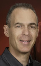
This month's Topic: Bringing International Corporate Sustainability to Local Impact: The Intersection of Strategy and Results On the Ground Often, a consumer’s interaction with corporations that lead in international sustainability are rooted in traditional point of purchase or post consumption models, such as purchasing sustainable products or ensuring responsible disposal. Equally as often, corporations focus on collating good data and anecdotes for their annual report. But the true corporate leaders are those who approach sustainability as a systems innovation: working with their suppliers, strengthening the communities in which they operate, and growing the purchasing power of markets within which they sell. And often the greatest impact of these value chain-based implementations are in developing nations. This Month's Speaker: Gwen Davidow, Acting President, World Environment Center  The World Environment Center is an independent, global, non-profit,
non-advocacy organization that advances sustainable development through
the business practices of member companies and in partnership with
governments, multi-lateral organizations, non-governmental
organizations, universities and other stakeholders. The World Environment Center is an independent, global, non-profit,
non-advocacy organization that advances sustainable development through
the business practices of member companies and in partnership with
governments, multi-lateral organizations, non-governmental
organizations, universities and other stakeholders.WEC creates sustainable business solutions through individual projects in emerging markets; convenes leadership roundtables to shape strategic thinking across a range of sustainability topics. Ms. Davidow will share WEC’s experience in working with their members and governments in advising on and implementing "systems innovation" programs.  Thanks again to Green America for partnering with Green Business Roundtable and hosting this month's gathering Date: Wednesday, May 2, 2018 Time: 11:30 am - 1:00 pm Location: Offices of Green America - 1612 K Street, NW, Suite 600, Washington DC Lunch included |